


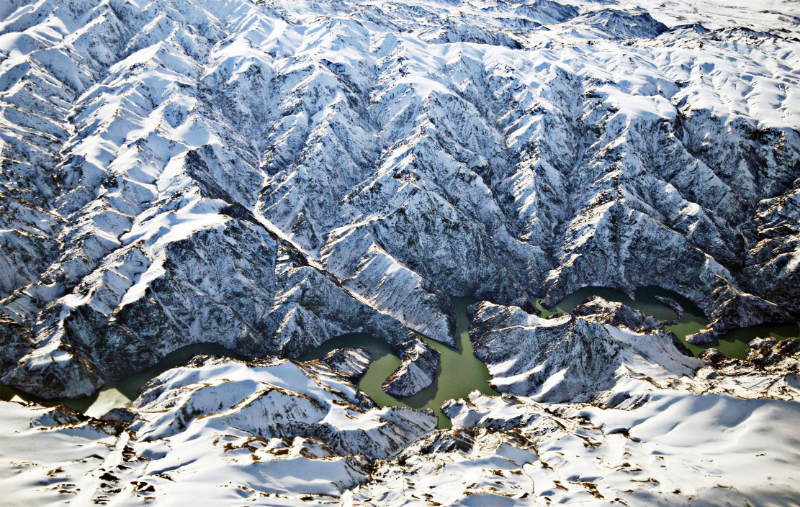
Magnificent canyon between the Tianshan Mountains in winter (File photo)
Tianshan Mountains, one of the largest mountain systems in Asia, are about 1700 kilometers long from east to west and 250 to 300 kilometers wide from north to south, accounting for 1/3 of the area of China's Xinjiang.
In ancient times, Tianshan Mountains were known as Beishan Mountain and Yinshan Mountain. Tianshan Mountains were folded mountains in Paleozoic era, characterizing by high mountains with an altitude of more than 45 kilometers. The altitude of the mountains is high in the west and low in the east, with snow mountains and ice peaks standing side by side. At an altitude of 7443 meters, the Tomur Peak is the highest peak in the Tianshan Mountains.
Based on the geomorphic composition, the Tianshan Mountains are divided into three parts: the north, east and middle. In the three parts, there are mountains that are roughly parallel, which are Bogda Mountain, Barkol Mountain, and Harlik Mountain in the east part of the Tianshan Mountains, all of which are relatively wide and thick; Alatao Mountain, Borokonu Mountain, and Yilianhabierga Mountain in the north part of Tianshan Mountains; and Wusun Mountain, Nalati Mountain, and Erbin Mountain in the middle part of the Tianshan Mountains.
(A written permission shall be obtained for reprinting, excerpting, copying and mirroring of the contents published on this website. Unauthorized aforementioned act shall be deemed an infringement, of which the actor shall be held accountable under the law.)