When we think about deserts, what usually comes to mind? Lately, Xinjiang's deserts have been gaining attention for their hidden treasures! Not only do the deserts in Xinjiang yield mouthwatering seafood, delicious mushrooms, and sweet, crisp apples, but it also boasts vast fields of aromatic rice. All of these are the results of the improved ecological environment of the deserts! But among these riches, how much do you know about the desert highways?
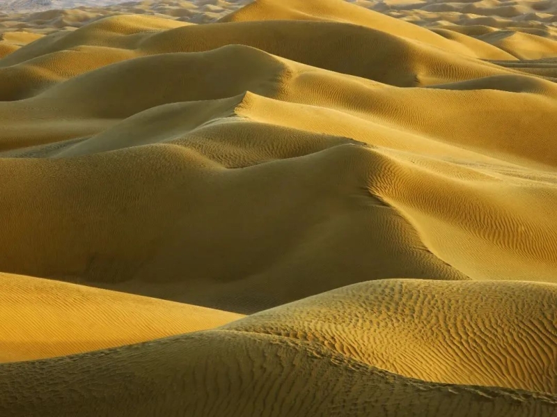
There are deserts in several provinces in China, with Xinjiang and Inner Mongolia being the regions with the largest desert areas. In particular, Xinjiang is home to the largest desert in China and the tenth largest in the world -- the Taklimakan Desert. This desert covers an area of 330,000 square kilometers, about 20 percent of Xinjiang's total land area. It stretches about 1,000 kilometers from east to west and about 400 kilometers from north to south, earning it the name "Sea of Death."

File photo shows vast desert area in northwest China’s Xinjiang Uygur Autonomous Region.
For a long time, the Taklimakan Desert posed a barrier to communication among the people living in southern Xinjiang. However, the construction of many desert highways has had a transformative effect on travel, and the extensive road network has made desert tourism increasingly popular.
The construction of highways in the desert region of Xinjiang began in the 1990s, primarily aimed at facilitating the extraction of oil and gas resources. The first desert highway, connecting Luntai to Minfeng, is known as the Tarim Desert Highway, as it was the first of its kind in the Tarim Basin.
This highway spans a total length of 552 kilometers, with 446 kilometers traversing shifting sand dunes. During the construction, transporting building materials proved impractical, so the builders innovatively sourced materials directly from the desert. They first shaped the roadbed with sand, then fixed it with geotextiles and compacted it by vibration.
With a solid roadbed established, a thin layer of gravel was laid on top, which effectively enhances the stability of the sandy foundation. In September 1995, the Tarim Desert Highway was completed and opened to traffic, marking it as the first desert highway in Xinjiang and even in China, providing valuable insights for future desert road construction in Xinjiang.

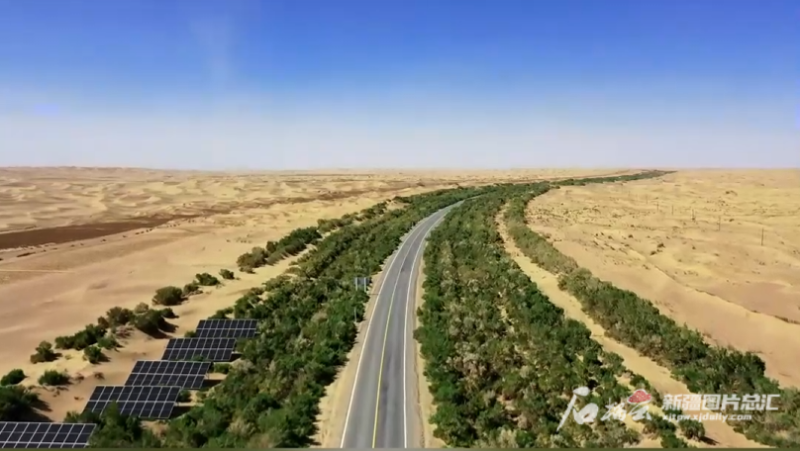
File photo shows the Minfeng section of the Tarim Desert Highway in northwest China’s Xinjiang Uygur Autonomous Region.
Drawing from the experience of building roads in arid conditions, the Alar to Hotan highway, spanning nearly 425 kilometers, was opened to traffic in October 2007. Subsequently, the 334-kilometer highway from Yuli to Qiemo was inaugurated on June 30, 2022. By December 2023, the highway connecting Tumxuk City with Kunyu City was put into operation, marking the completion of four major highways traversing the "Sea of Death."
Simultaneously, the people of Xinjiang have constructed the road from Alar City to Tazhong Town in Qiemo County within the Taklimakan Desert. This road runs diagonally, linking multiple desert routes and creating a network of roads within the desert.

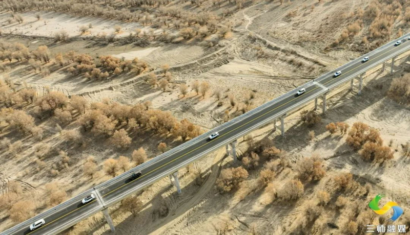
Photo taken on December 1, 2023 shows the desert highway connecting Tumxuk City with Kunyu City in northwest China's Xinjiang Uygur Autonomous Region.
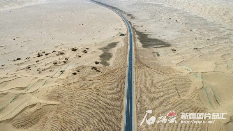
The Taklimakan Desert is characterized as a shifting sand desert, making sand prevention and stabilization crucial. Builders have employed straw checkerboard sand barriers to stabilize the moving sand dunes.
Straw checkerboard sand barriers are a typical example of sand control technology. Utilizing materials such as wheat straw, rice straw, and reeds, windbreak walls are constructed in a grid pattern on the shifting dunes. This increases the roughness of the sand surface, reduces wind velocity, and prevents the wind from carrying away loose sand particles. This method not only protects against wind erosion but also captures precipitation.
Taking the Yuli to Qiemo desert highway as an example, during construction, workers simultaneously built grass grids alongside the road in accordance with the construction schedule. Upon completion, over 58 million square meters of straw checkerboard were established on both sides of the highway by using about 70,000 tons of reeds. If these reeds were laid end to end, they could circle the Earth's equator about 180 times.

File photo shows an overlooking view of the highway that connects Yuli County and Qiemo County in northwest China's Xinjiang Uygur Autonomous Region. (Photo by Cho Hura)
Straw checkerboard are not enough. When the first desert highway was constructed, the surrounding protective forest project commenced simultaneously. Completed in 2005, the ecological protective forest belt stretches 436 kilometers and has seen the planting of over 20 million salt-tolerant shrubs, including Haloxylon ammodendron, red willow, and Calligonum mongolicum. These protective forests serve to stabilize the sand and prevent the road from being eroded or buried by windblown sand.
To ensure the vitality of this lush green corridor, water wells are strategically placed every few kilometers along the route, totaling 108 wells, each monitored by designated personnel.

File photo taken on April 2023 shows workers lay straw checkerboard along the highway connecting Tumxuk City with Kunyu City in northwest China's Xinjiang Uygur Autonomous Region. (Photo offered by the Media Convergence Center of Tumxuk City)
Surrounding the vast Taklimakan Desert, desert highways, expressways, and circular railways have been constructed. The once-isolated "Sea of Death" is now encircled by roads and railways, breaking the previous state of isolation and fostering increasingly close economic and cultural exchanges among people.
(Original source: Xinjiang Release)


